Lower Clwyd Street & The Star
What better place for GARETH EVANS to explore the importance of lower Clwyd
Street and its mysteries than in The Star itself, during December 2017’s packed
RADCA social
The bottom of Clwyd Street was no ordinary
street. It was an important mediæval
thoroughfare. Clwyd Street formed part of the
mediæval Pilgrims’ Route linking South West &
North Wales. Locally, it ran through Derwen,
Efenechtyd, over the longford at Clwyd Street to
the Square, Prior Street, Park Gates and
Wernfechan. The longford was
one of few river
crossing points.
Mediæval Period
Clwyd Street was therefore
part of the link between the
junction of five roads at
Llanfwrog and the five at
Anchor Corner. With the
development of the princely
court at Ruthin and later
lordship markets & fairs,
trade developed at the
bottom of Clwyd Street. It
was as busy there as the
Square. Activity was further
strengthened by the mill
which, from 1284, benefited from the millpond
and leet enabling all year operation. Does the
mill’s east gable cross suggest a religious link?
Since the mill was in the castle precinct, it was
likely the lord’s not the prior’s mill. As the
former, its use was compulsory, generating
footfall.
The Burgess’ Tower or Turrun is of unknown
origins but was built on the town side of the mill
leet probably in the 1280s. It defined the main
access point into town and probably resulted in
the stopping up of Mill Street: why go to the
expensive of a tower but keep a second entry
nearby? Why, though, did the tower remain
outside the Edwardian and Glyndŵr defences?
It was probably in the late 15th century that the
tower had fallen into disuse. In Tudor times, the
tower had become a prison. John & Carol Smith
of Porth y Dŵr suggest that, from c.1460,
adjacent Porth y Dŵr was an open two-storey
building with a fine timbered ceiling from a
managed forest which, they think, suggests it
was de Grey’s. He was the patron of a local
school of carpenters then working on the nave
at St Peter’s. Was the open space an inspection
& weighing space for goods? If so, the fine
ceiling suggests they would have been of high
value. The tanners of Mwrog Street were
probably not producing enough leather to
command such a building. The only possible
alternative was wool. The 1447 guild of weavers
brought together the specialist wool trades and
the lord as backer would have ensured it was
centred on Ruthin and its fairs. The 17th century
collapse of the de Greys would have ended this
Ruthin initiative.
The Stuarts
From about the 1660s, the town built Pont
Howkin and a number of properties at the
bottom of Clwyd Street. Indeed, some new
buildings replaced demolished older properties.
Why build on such a scale? Was this the result of
military action? Was it here that the
Parliamentary forces assaulted Ruthin? The
result was a reshaped street of new properties.
There was also a house of correction there and
from 1661 a new county gaol. Was the site
chosen because of the earlier destruction,
making it easy to build on?
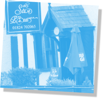
It was at this point that we see the 17th century
purpose-built Star, though parts may pre-date
this period. In 1756, it was named the North
Pole, becoming the Star in 1775. It was ideally
situated and offered food, drink &
accommodation.
18th Century
During this period,
overcrowding resulted in
the Gaol expanding by
displacing a tannery and
devouring mediæval
streets for buildings &
additional walls. All of the
pre-1775 buildings were
soon replaced.
The last of the mediæval
gateway was cleared by
the spring of 1787. Mill
Cottage, 65 and 67 Clwyd
Street probably have more to reveal about the
Burgess tower and may even have developed
out of it once its defensive function became
obsolete.
John Williams’s Star—19th Century
During the Star’s restoration—which resulted in
the 2011 Quayle Award—builders discovered
old documents relating to John Williams’s time
from 1837 as publican. During his time, the Star
would have watched the comings & goings at
the gaol. With a population in 1841 of 2,431, the
Star competed with 50 other hostelries, nine of
which were on Clwyd Street with a further two
beer retailers. The Star’s unique feature
continued to be stables to its rear, an important
source of income. At this period, the Star had its
own field for barley for malt and brewing would
have been a constant process. The Star
originally supplied the gaol with beer probably
till the Home Office took the gaol over in 1878.
Weak though it was, beer was safer to drink
than water. The Star served breakfast, lunch,
evening meals as well as “servants’ eatings”. The
parlour would have been comfortable. Kept pigs
ate the scraps.
Williams sourced groceries locally but spirits
and malt from as far afield as Chester, Chirk
wharf and Liverpool docks. Thrift—the repair of
fittings and features—was constant, involving
local craftsmen. This was probably at the Star’s
zenith.
20th Century
The gaol closed in 1916. The motor car hit the
stable & carriage business. A steady decline in
beer consumption towards the end of the 19th
century followed a complete collapse in 1914.
Passing trade diverted at the 1960s re-
designation of Park Road as the trunk road.
The Star Today
It’s fair to say that the Star has had its ups and
downs. 2010 saw a refurbishment and re-
opening after a period of closure. The Star
continues to provide similar services to those
which
it did some 400 years ago. It is the sole-
surviving public house in this part of town.

Town and Around Current Edition
Town and Around Historic Contents
Contact Us
Ruthin Local Historic Society
Copyright © 2018 Ruthin & District Civic Association


